
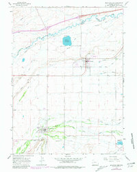
1964 Map of Mountain View
USGS Topo · Published 1968About this map
Mountain View and Lyman anchor this mid-1960s landscape, serving as the primary residential and agricultural hubs within the Bridger Valley. The irrigation network is central to the area's development, with a complex system of Pipelines and Canals drawing from Blacks Fork and Smiths Fork to water the high-altitude plains. The presence of the Rollins Reservoir and various gravel pits suggests an economy tied to both water management and local resource extraction.
Find a feature on this map
31 named features on this map. Tap any name to fly to it.
Don’t see what you’re looking for? This feature index may not catch every label — zoom into the map to look around manually.
Map Details
Editions of this 1964 Mountain View Map
2 editions found
Other maps of this area

1954 · Ogden
USGS Topo · 1:250,000

1958 · Ogden
USGS Topo · 1:250,000

1960 · Ogden
USGS Topo · 1:250,000

1964 · Reed Reservoir
USGS Topo · 1:24,000

1964 · Fort Bridger
USGS Topo · 1:24,000

1964 · Carter
USGS Topo · 1:24,000

1964 · Austin Reservoir
USGS Topo · 1:24,000
1964 · Leavitt Bench
USGS Topo · 1:24,000
1964 · Robertson
USGS Topo · 1:24,000
1965 · Millersville
USGS Topo · 1:24,000