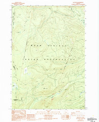
1988 Map of Fort Butte
USGS Topo · Published 1994About this map
The Warm Springs Indian Reservation and Mt Hood National Forest meet in this high-elevation landscape, where historical boundary lines including the (Mc Quinn Line 1887) and the (Campbell Line 1971) trace the complex management history of Oregon’s central mountains. Dominating the topography is the prominent Fort Butte, surrounded by a web of seasonal drainages and meadows such as Camas Prairie and Lemiti Meadow.
Find a feature on this map
25 named features on this map. Tap any name to fly to it.
Don’t see what you’re looking for? This feature index may not catch every label — zoom into the map to look around manually.
Map Details
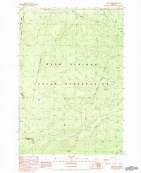
Editions of this 1988 Fort Butte Map
2 editions found
Other maps of this area

1924 · Mount Hood
USGS Topo · 1:125,000

1927 · Mount Hood
USGS Topo · 1:125,000

1927 · Mt. Jefferson
USGS Topo · 1:125,000

1930 · Mt. Jefferson
USGS Topo · 1:125,000

1953 · The Dalles
USGS Topo · 1:250,000

1955 · Bend
USGS Topo · 1:250,000

1956 · The Dalles
USGS Topo · 1:250,000

1956 · High Rock
USGS Topo · 1:62,500

1956 · Mt. Wilson
USGS Topo · 1:62,500

1957 · Bend
USGS Topo · 1:250,000