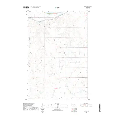
2018 Map of Fort Clark
USGS Topo · Published 2018About this map
Fort Clark stands at the northern edge of this high plains landscape, situated near the boundary where McLean Co meets Oliver Co. The terrain is defined by a rhythmic series of coulees and draws that drain toward the Missouri River valley just beyond the map's margin. This 2018 survey reveals a highly organized section line road network, including routes like 32rd Ave SW and 15th St SW, which partition the land into the traditional township and range grid characteristic of North Dakota's agricultural heartland. In the northeast corner, the presence of Mandan Lake provides a rare permanent water feature amidst the undulating hills, offering a focal point for local geography in an otherwise vast expanse of open prairie and cultivated fields.
Find a feature on this map
21 named features on this map. Tap any name to fly to it.
Don’t see what you’re looking for? This feature index may not catch every label — zoom into the map to look around manually.
Map Details
Editions of this 2018 Fort Clark Map
This is the sole edition of this map. No revisions or reprints were ever made.
Other maps of this area

1948 · Stanton
USGS Topo · 1:62,500

1949 · Stanton
USGS Topo · 1:62,500

1949 · Washburn
USGS Topo · 1:62,500

1954 · McClusky
USGS Topo · 1:250,000

1958 · McClusky
USGS Topo · 1:250,000

1961 · Washburn
USGS Topo · 1:24,000

1967 · Washburn SW
USGS Topo · 1:24,000

1967 · Stanton SE
USGS Topo · 1:24,000

1968 · Hannover NE
USGS Topo · 1:24,000

1968 · Fort Clark
USGS Topo · 1:24,000