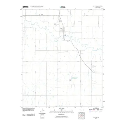
2009 Map of Fort Cobb
USGS Topo · Published 2009About this map
Fort Cobb anchors this Caddo County landscape, situated along the winding course of the Washita River. The town is surrounded by a dense grid of rural routes, including N2560 Rd and E1330 Rd, which connect outlying farms and ranches. Significant water management features define the area's modern agricultural character, most notably the Fort Cobb Laterals Site 7 Reservoir and its associated Fort Cobb Laterals Site 7 Dam.
Find a feature on this map
30 named features on this map. Tap any name to fly to it.
Don’t see what you’re looking for? This feature index may not catch every label — zoom into the map to look around manually.
Map Details
Editions of this 2009 Fort Cobb Map
This is the sole edition of this map. No revisions or reprints were ever made.
Other maps of this area

1950 · Saddle Mountain
USGS Topo · 1:62,500

1951 · Fort Cobb
USGS Topo · 1:62,500

1955 · Lawton
USGS Topo · 1:250,000

1955 · Clinton
USGS Topo · 1:250,000

1956 · Alden
USGS Topo · 1:24,000

1956 · Boone
USGS Topo · 1:24,000

1956 · Apache
USGS Topo · 1:24,000

1956 · Apache
USGS Topo · 1:62,500

1956 · Saddle Mountain
USGS Topo · 1:62,500

1957 · Clinton
USGS Topo · 1:250,000