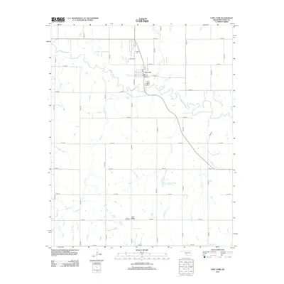
2012 Map of Fort Cobb
USGS Topo · Published 2012About this map
The Washita River meanders across this landscape in Caddo County, defining the northern geography near the community of Fort Cobb. The town is situated just south of the river, where local life centers around streets like Ponjo Ave and Mopope St. To the north of the settlement sits the Ft Cobb Cem, while further south, the Pleasant View Cem is located near the rise of Pine Ridge. The region is marked by a dense network of tributaries and drainage features, including Cobb Cr, Two Hatchet Cr, and Buzzard Cr, which reflect the area's agricultural reliance on water management, particularly seen in the Fort Cobb Laterals Site 7 Reservoir. This survey documents a rural Oklahoma landscape shaped by its waterway systems and a grid of section-line roads.
Find a feature on this map
39 named features on this map. Tap any name to fly to it.
Don’t see what you’re looking for? This feature index may not catch every label — zoom into the map to look around manually.
Map Details
Editions of this 2012 Fort Cobb Map
This is the sole edition of this map. No revisions or reprints were ever made.
Other maps of this area

1950 · Saddle Mountain
USGS Topo · 1:62,500

1951 · Fort Cobb
USGS Topo · 1:62,500

1955 · Lawton
USGS Topo · 1:250,000

1955 · Clinton
USGS Topo · 1:250,000

1956 · Alden
USGS Topo · 1:24,000

1956 · Boone
USGS Topo · 1:24,000

1956 · Apache
USGS Topo · 1:24,000

1956 · Apache
USGS Topo · 1:62,500

1956 · Saddle Mountain
USGS Topo · 1:62,500

1957 · Clinton
USGS Topo · 1:250,000