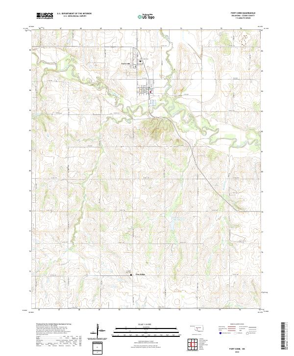
2022 Map of Fort Cobb
USGS Topo · Published 2022About this map
Fort Cobb serves as the focal point of this Caddo County landscape, situated near the confluence of the Washita River and Cobb Cr. The town's grid is clearly defined, featuring streets like Main St, Hazlett St, and Towakonie Ave. The surrounding terrain is a network of agricultural sections and drainages, where various creeks such as Two Hatchet Cr, Buzzard Cr, and Spring Cr carve through the plains.
Find a feature on this map
49 named features on this map. Tap any name to fly to it.
Don’t see what you’re looking for? This feature index may not catch every label — zoom into the map to look around manually.
Map Details
Editions of this 2022 Fort Cobb Map
This is the sole edition of this map. No revisions or reprints were ever made.
Other maps of this area

1950 · Saddle Mountain
USGS Topo · 1:62,500

1951 · Fort Cobb
USGS Topo · 1:62,500

1955 · Lawton
USGS Topo · 1:250,000

1955 · Clinton
USGS Topo · 1:250,000

1956 · Alden
USGS Topo · 1:24,000

1956 · Boone
USGS Topo · 1:24,000

1956 · Apache
USGS Topo · 1:24,000

1956 · Apache
USGS Topo · 1:62,500

1956 · Saddle Mountain
USGS Topo · 1:62,500

1957 · Clinton
USGS Topo · 1:250,000