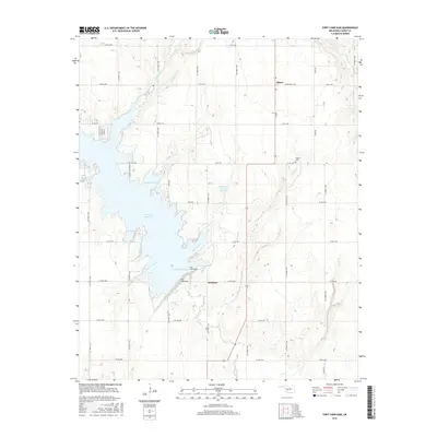
2016 Map of Fort Cobb Dam
USGS Topo · Published 2016About this map
Fort Cobb Reservoir dominates this Caddo County landscape, its western shoreline deeply articulated by inlets like Carnegie Cove and Farmers Slough. The impoundment is held by the Fort Cobb Dam at its southern end, where Cobb Cr exits the basin. In the northeast, the small settlement of Albert sits at the junction of N Main and Albert-Oney Ave, accompanied by the nearby Albert Cem. Further south, the curiously named settlement of Nowhere is situated along Co Rd 1280 near the banks of Punjo Cr. The map details a transition from the structured grid of rural roads, such as Co Street 2550, to the irregular, hydrologically influenced terrain of the reservoir's edge, including the Kardokas Slough and various smaller water bodies like the Oknaname 015018 Reservoir.
Find a feature on this map
46 named features on this map. Tap any name to fly to it.
Don’t see what you’re looking for? This feature index may not catch every label — zoom into the map to look around manually.
Map Details
Editions of this 2016 Fort Cobb Dam Map
This is the sole edition of this map. No revisions or reprints were ever made.
Other maps of this area

1951 · Binger
USGS Topo · 1:62,500

1951 · Fort Cobb
USGS Topo · 1:62,500

1955 · Clinton
USGS Topo · 1:250,000

1957 · Clinton
USGS Topo · 1:250,000

1961 · Eakly
USGS Topo · 1:62,500

1961 · Carnegie
USGS Topo · 1:62,500
1979 · Anadarko West
USGS Topo · 1:24,000

1979 · Sickles
USGS Topo · 1:24,000
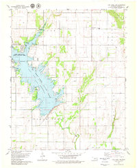
1979 · Fort Cobb Dam
USGS Topo · 1:24,000
1979 · Binger
USGS Topo · 1:24,000