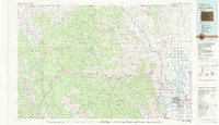
1980 Map of Fort Collins
USGS Topo · Published 1981About this map
Fort Collins stands at the transition between the eastern plains and the dramatic Front Range as it appeared in 1980. The city center is anchored by the Colorado State University campus, with residential expansion moving toward Harmony and the base of the foothills. To the west, the Cache la Poudre River winds through narrow canyons, passing landmarks like Mishawaka and Indian Meadows as it descends from the high country of the Roosevelt National Forest. This era shows the developed water infrastructure essential to Larimer County, including the prominent Horsetooth Reservoir and numerous smaller irrigation basins like Windsor Reservoir.
Find a feature on this map
57 named features on this map. Tap any name to fly to it.
Don’t see what you’re looking for? This feature index may not catch every label — zoom into the map to look around manually.
Map Details
Editions of this 1980 Fort Collins Map
This is the sole edition of this map. No revisions or reprints were ever made.
Other maps of this area

1895 · Laramie
USGS Topo · 1:125,000

1902 · Laramie
USGS Topo · 1:125,000

1902 · Greeley
USGS Topo · 1:125,000

1905 · Sherman
USGS Topo · 1:125,000

1905 · Laramie
USGS Topo · 1:125,000

1905 · Mount Olympus
USGS Topo · 1:62,500

1906 · Loveland
USGS Topo · 1:62,500

1906 · Fort Collins
USGS Topo · 1:62,500

1906 · Medicine Bow
USGS Topo · 1:125,000

1906 · Laramie
USGS Topo · 1:125,000