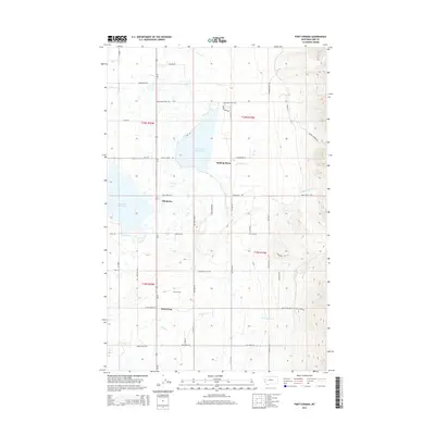
2014 Map of Fort Connah
USGS Topo · Published 2014About this map
Fort Connah stands as a primary historical landmark within this landscape, situated near the modern thoroughfare of Us-93. The map documents a complex hydraulic environment defined by the Kicking Horse Reservoir and the Ninepipe Reservoir, connected by engineered features like the Kicking Horse Feeder Canal. Settlements such as Allentown, Kicking Horse, and Post Creek are distributed along the valley floor, while the eastern terrain rises sharply toward the Mission Range foothills. Local nomenclature reflects both the wildlife and the transit history of the region, seen in names like Grizzly Hollow Ln, Mollmann Pass Trl, and Eagle Pass Cr. The map captures a mix of agricultural irrigation patterns and the natural drainage of numerous creeks, including Crow Cr and Post Cr, which flow westward from the high ridges.
Find a feature on this map
59 named features on this map. Tap any name to fly to it.
Don’t see what you’re looking for? This feature index may not catch every label — zoom into the map to look around manually.
Map Details
Editions of this 2014 Fort Connah Map
This is the sole edition of this map. No revisions or reprints were ever made.
Other maps of this area

1920 · Flathead Lake
USGS Topo · 1:125,000

1921 · Elbow Lake
USGS Topo · 1:125,000

1955 · Choteau
USGS Topo · 1:250,000

1956 · Wallace
USGS Topo · 1:250,000

1957 · Choteau
USGS Topo · 1:250,000

1958 · Choteau
USGS Topo · 1:250,000

1960 · Wallace
USGS Topo · 1:250,000

1962 · Choteau
USGS Topo · 1:250,000

1964 · Fort Connah
USGS Topo · 1:24,000

1964 · Ronan
USGS Topo · 1:24,000