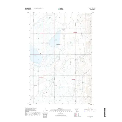
2020 Map of Fort Connah
USGS Topo · Published 2020About this map
The historic trading post site of Fort Connah anchors the center of this landscape, situated between the expansive waters of Ninepipe Reservoir and the rising peaks of the Mission Range. The map reveals a complex water management and agricultural network defined by Kicking Horse Reservoir and numerous irrigation canals and streams such as Crow Cr and Post Creek. Small communities like Allentown and Kicking Horse are connected by a grid of rural roads including Olsen Rd and McDonald Lake Rd, while more primitive routes like Mollman Pass Trl and Eagle Pass Trl ascend the steep eastern ridges. This terrain transitions abruptly from the flat, water-dotted valley floor into the high elevations of Grizzly Hollow, illustrating the typical geography of the Flathead Valley where human settlement and irrigation meet the wilderness of the western front.
Find a feature on this map
55 named features on this map. Tap any name to fly to it.
Don’t see what you’re looking for? This feature index may not catch every label — zoom into the map to look around manually.
Map Details
Editions of this 2020 Fort Connah Map
This is the sole edition of this map. No revisions or reprints were ever made.
Other maps of this area

1920 · Flathead Lake
USGS Topo · 1:125,000

1921 · Elbow Lake
USGS Topo · 1:125,000

1955 · Choteau
USGS Topo · 1:250,000

1956 · Wallace
USGS Topo · 1:250,000

1957 · Choteau
USGS Topo · 1:250,000

1958 · Choteau
USGS Topo · 1:250,000

1960 · Wallace
USGS Topo · 1:250,000

1962 · Choteau
USGS Topo · 1:250,000

1964 · Fort Connah
USGS Topo · 1:24,000

1964 · Ronan
USGS Topo · 1:24,000