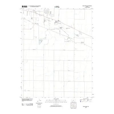
2009 Map of Fort Dodge
USGS Topo · Published 2009About this map
Fort Dodge serves as a focal point of this Kansas landscape, reflecting its historical significance at the crossroads of early Western expansion. The map details the transition from small settlements like Riverview Camp and Wilroads Gardens to the more structured grid of Ford County. Established as a military outpost along the Santa Fe Trail, the area near Fort Dodge is defined by roads carrying the names of military figures such as Custer, Pershing, and Macarthur, illustrating the lasting impact of the fort's heritage on local geography. Further east, Wilroads Gardens Airport and the community of Wilroads mark the edge of the irrigation-driven agricultural developments that characterize this portion of the High Plains. To the north, Coon Creek cuts through the terrain, providing a natural drainage feature amidst a increasingly formal network of numbered country roads and named avenues like E Trail St and Lariat Dr.
Find a feature on this map
35 named features on this map. Tap any name to fly to it.
Don’t see what you’re looking for? This feature index may not catch every label — zoom into the map to look around manually.
Map Details
Editions of this 2009 Fort Dodge Map
This is the sole edition of this map. No revisions or reprints were ever made.
Other maps of this area

1892 · Dodge
USGS Topo · 1:125,000

1892 · Spearville
USGS Topo · 1:125,000

1894 · Spearville
USGS Topo · 1:125,000

1955 · Pratt
USGS Topo · 1:250,000

1955 · Dodge City
USGS Topo · 1:250,000

1958 · Dodge City
USGS Topo · 1:250,000

1959 · Pratt
USGS Topo · 1:250,000

1959 · Dodge City
USGS Topo · 1:250,000

1968 · Dodge City
USGS Topo · 1:24,000
1969 · South Dodge
USGS Topo · 1:24,000