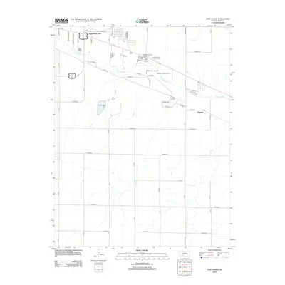
2012 Map of Fort Dodge
USGS Topo · Published 2012About this map
The Fort Dodge military reservation and medical facilities dominate the northern banks of the Arkansas River in this 2012 survey of eastern Ford County. This area is defined by the legacy of the Old West frontier, now home to the Kansas Veterans' Cem at Ft Dodge and the Dodge City Pershing Barracks Post Hospital. To the west, the residential development of Happy Homes Park sits near the river bend, while the small community of Wilroads Gardens and its namesake Wilroads Gardens Airport lie to the east. South of the river, the landscape transitions into a grid of rural roads and drainage patterns like Coon Cr. The map captures the specialized institutional land use at the fort alongside agricultural tracts and modern subdivisions like Wilroads, reflecting the long-term evolution of this historic corridor.
Find a feature on this map
44 named features on this map. Tap any name to fly to it.
Don’t see what you’re looking for? This feature index may not catch every label — zoom into the map to look around manually.
Map Details
Editions of this 2012 Fort Dodge Map
This is the sole edition of this map. No revisions or reprints were ever made.
Other maps of this area

1892 · Dodge
USGS Topo · 1:125,000

1892 · Spearville
USGS Topo · 1:125,000

1894 · Spearville
USGS Topo · 1:125,000

1955 · Pratt
USGS Topo · 1:250,000

1955 · Dodge City
USGS Topo · 1:250,000

1958 · Dodge City
USGS Topo · 1:250,000

1959 · Pratt
USGS Topo · 1:250,000

1959 · Dodge City
USGS Topo · 1:250,000

1968 · Dodge City
USGS Topo · 1:24,000
1969 · South Dodge
USGS Topo · 1:24,000