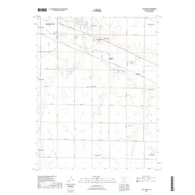
2018 Map of Fort Dodge
USGS Topo · Published 2018About this map
Fort Dodge and the southeastern outskirts of Dodge City anchor this landscape along the northern banks of the Arkansas River. This survey captures the transition from urban grid to the open plains of Ford County, highlighting the established footprint of the Kansas Veterans Cem at Fort Dodge and the nearby residential pockets of Wilroads Gardens and Wilroads. The river's path is a primary geographic driver, shadowed by historic transit corridors like Ft Dodge Rd and E Trail St. The surrounding countryside is divided by a series of straight-line section roads, including Quaker Rd and Ford Ensign Rd, which delineate the agricultural reaches south of the river valley. To the northeast, the terrain is cut by the drainage of Coon Cr, providing a contrast to the flatter, surveyed blocks that dominate the township sections.
Find a feature on this map
35 named features on this map. Tap any name to fly to it.
Don’t see what you’re looking for? This feature index may not catch every label — zoom into the map to look around manually.
Map Details
Editions of this 2018 Fort Dodge Map
This is the sole edition of this map. No revisions or reprints were ever made.
Other maps of this area

1892 · Dodge
USGS Topo · 1:125,000

1892 · Spearville
USGS Topo · 1:125,000

1894 · Spearville
USGS Topo · 1:125,000

1955 · Pratt
USGS Topo · 1:250,000

1955 · Dodge City
USGS Topo · 1:250,000

1958 · Dodge City
USGS Topo · 1:250,000

1959 · Pratt
USGS Topo · 1:250,000

1959 · Dodge City
USGS Topo · 1:250,000

1968 · Dodge City
USGS Topo · 1:24,000
1969 · South Dodge
USGS Topo · 1:24,000