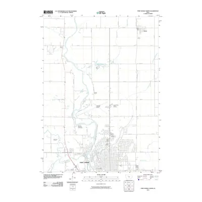
2010 Map of Fort Dodge North
USGS Topo · Published 2010About this map
The Des Moines River flows through the center of this northern Webster County landscape, serving as the primary geographical anchor for the city of Fort Dodge. The area is marked by a dense concentration of burial grounds concentrated along the river bluffs and city periphery, including Saint Paul Cemetery, North Lawn Cemetery, and Corpus Christi Cemetery. These sites, alongside others like Saint Olafs Cemetery and Concordia Cemetery, provide significant data points for local genealogical research.
Find a feature on this map
52 named features on this map. Tap any name to fly to it.
Don’t see what you’re looking for? This feature index may not catch every label — zoom into the map to look around manually.
Map Details
Editions of this 2010 Fort Dodge North Map
This is the sole edition of this map. No revisions or reprints were ever made.
Other maps of this area

1923 · Lehigh
USGS Topo · 1:62,500

1923 · Fort Dodge
USGS Topo · 1:62,500

1954 · Fort Dodge
USGS Topo · 1:250,000

1957 · Fort Dodge
USGS Topo · 1:250,000

1958 · Fort Dodge
USGS Topo · 1:250,000

1965 · Moorland
USGS Topo · 1:24,000

1965 · Fort Dodge South
USGS Topo · 1:24,000

1965 · Evanston
USGS Topo · 1:24,000
1979 · Fort Dodge North
USGS Topo · 1:24,000
1979 · Thor
USGS Topo · 1:24,000