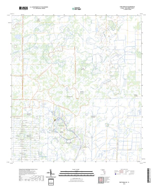
2024 Map of Fort Drum SW
USGS Topo · Published 2024About this map
Everglades Headwaters National Wildlife Refuge and Conservation Area dominates the northern reaches of this Okeechobee County landscape, where the flat palmetto prairies transition into complex wetland systems. The terrain is defined by numerous hammocks—elevated islands of hardwood trees—often named for local families or landmarks, such as Thomas Hammock, Padgett Hammock, and Irvin Hammock. These features, along with Indian Town Hammock and Turkey Roost Hammock, provide critical dry ground within the broader drainage network of Sevenmile Slough and Fish Slough.
Find a feature on this map
60 named features on this map. Tap any name to fly to it.
Don’t see what you’re looking for? This feature index may not catch every label — zoom into the map to look around manually.
Map Details
Editions of this 2024 Fort Drum SW Map
This is the sole edition of this map. No revisions or reprints were ever made.
Other maps of this area

1953 · Taylor Creek NW
USGS Topo · 1:24,000

1953 · Basinger
USGS Topo · 1:24,000

1953 · Fort Drum
USGS Topo · 1:24,000

1953 · Fort Kissimmee NE
USGS Topo · 1:24,000

1953 · Fort Drum SW
USGS Topo · 1:24,000

1953 · Fort Drum NW
USGS Topo · 1:24,000

1953 · Fort Drum NE
USGS Topo · 1:24,000

1953 · Fort Kissimmee SE
USGS Topo · 1:24,000

1953 · Taylor Creek NE
USGS Topo · 1:24,000

1956 · Fort Pierce
USGS Topo · 1:250,000