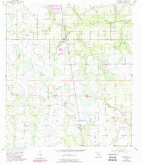
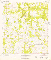
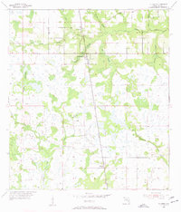
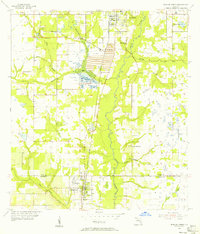
1955 Map of Fort Green
USGS Topo · Published 1987About this map
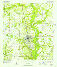
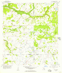
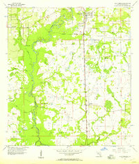
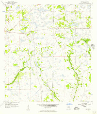
Payne Creek and its many tributaries, including Hickey Branch, Olive Branch, and Shittail Creek, define the landscape of this Hardee County region. Originally surveyed in the mid-1950s with later updates, the map shows the transition of the Florida interior from native wetlands like Gum Swamp and Mitchell Hammock to industrial land uses. The presence of a Reclaimed Strip Mine in the north indicates the significant role of phosphate mining in this area's development. Small rural settlements are scattered throughout, notably at Ft Green, Ft Green Springs, and Vandolah. Local history is anchored by the Ft Green Post Office and the Olive Branch Cem, while the Wauchula Municipal Airport in the southeast corner marks the area's increasing connectivity. The map also records numerous unnamed trails and roads through the timber and marshlands, offering a look at the rural infrastructure before modern expansion.
Find a feature on this map
21 named features on this map. Tap any name to fly to it.
Don’t see what you’re looking for? This feature index may not catch every label — zoom into the map to look around manually.
Map Details
Editions of this 1955 Fort Green Map
3 editions found
Other maps of this area
1955 · Ft. Green
USGS Topo · 1:24,000
1955 · Bowling Green
USGS Topo · 1:24,000
1955 · Wauchula
USGS Topo · 1:24,000
1955 · Baird
USGS Topo · 1:24,000
1956 · Ona
USGS Topo · 1:24,000
1956 · Myakka Head
USGS Topo · 1:24,000
1956 · Duette NE
USGS Topo · 1:24,000
1956 · Zolfo Springs
USGS Topo · 1:24,000
1956 · Duette
USGS Topo · 1:24,000

1956 · Tampa
USGS Topo · 1:250,000