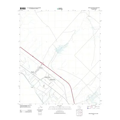
2013 Map of Fort Hancock
USGS Topo · Published 2013About this map
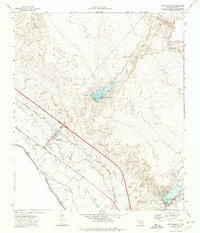
The Rio Grande corridor in Hudspeth County serves as the focal point for this 2013 survey, where the international border is marked by the El Porvenir Bridge. The settlement of Fort Hancock is surrounded by expanding residential developments including Villa Alegre Colonia and several units of Fort Hancock East Unit Number 1 Colonia. This borderland landscape is defined by an intricate network of irrigation and drainage infrastructure essential for desert agriculture, such as the Davis Lateral, McNary Lateral, and School Drain.
Find a feature on this map
28 named features on this map. Tap any name to fly to it.
Don’t see what you’re looking for? This feature index may not catch every label — zoom into the map to look around manually.
Map Details
Editions of this 2013 Fort Hancock Map
This is the sole edition of this map. No revisions or reprints were ever made.
Other maps of this area

1894 · Fort Hancock
USGS Topo · 1:125,000

1943 · Fort Quitman
USGS Topo · 1:62,500

1943 · Finlay Mountains
USGS Topo · 1:62,500

1943 · Fort Hancock
USGS Topo · 1:62,500
1943 · McNary
USGS Topo · 1:62,500

1954 · Van Horn
USGS Topo · 1:250,000

1958 · Van Horn
USGS Topo · 1:250,000
1972 · Campo Grande Mountain
USGS Topo · 1:24,000
1972 · Fort Hancock NW
USGS Topo · 1:24,000
1972 · Fort Hancock
USGS Topo · 1:24,000
Featured Places
- Fort Hancock, TX
- Villa Alegre Colonia, TX
- Fort Hancock East Unit Number 2 Colonia, TX
- Fort Hancock East Unit Number 1 Colonia, TX
- Hudspeth County, TX