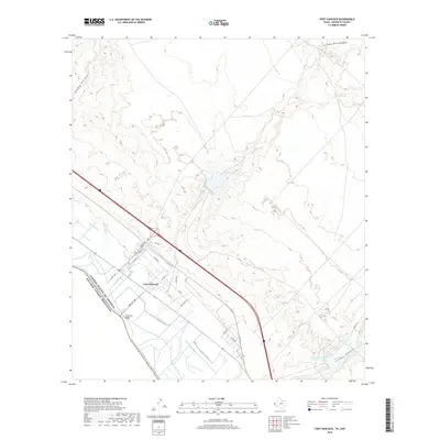
2019 Map of Fort Hancock
USGS Topo · Published 2019About this map
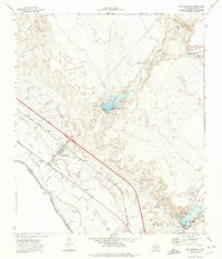
Fort Hancock serves as the focal point of this Hudspeth County borderland, situated where the high desert meets the irrigated agricultural corridor of the Rio Grande. The landscape is defined by its complex water management system, featuring an intricate network of channels such as Davis Lateral, McNary Lateral, and Middle Drain that support the valley's cultivation. Beyond the irrigated fields, the terrain rises into arid uplands carved by seasonal drainages including Alamo Arroyo and Arroyo Diablo, while Finley Tank provides a reliable water source in the higher elevations. The international border is clearly delineated, anchored by the El Porvenir Bridge, reflecting the community's role as a gateway between the United States of America and Estados Unidos Mexicanos. Locally named streets like Ross Ave and Huffman St trace the grid of the settlement, contrasting with the wide-reaching infrastructure of Farm Rd 1088.
Find a feature on this map
33 named features on this map. Tap any name to fly to it.
Don’t see what you’re looking for? This feature index may not catch every label — zoom into the map to look around manually.
Map Details
Editions of this 2019 Fort Hancock Map
This is the sole edition of this map. No revisions or reprints were ever made.
Other maps of this area

1894 · Fort Hancock
USGS Topo · 1:125,000

1943 · Fort Quitman
USGS Topo · 1:62,500

1943 · Finlay Mountains
USGS Topo · 1:62,500

1943 · Fort Hancock
USGS Topo · 1:62,500
1943 · McNary
USGS Topo · 1:62,500

1954 · Van Horn
USGS Topo · 1:250,000

1958 · Van Horn
USGS Topo · 1:250,000
1972 · Campo Grande Mountain
USGS Topo · 1:24,000
1972 · Fort Hancock NW
USGS Topo · 1:24,000
1972 · Fort Hancock
USGS Topo · 1:24,000
Featured Places
- Fort Hancock, TX
- Villa Alegre Colonia, TX
- Fort Hancock East Unit Number 2 Colonia, TX
- Fort Hancock East Unit Number 1 Colonia, TX
- Hudspeth County, TX