
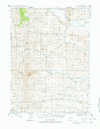
1945 Map of Fort Hill
USGS Topo · Published 1970About this map
Fort Hill rises as a prominent landmark in this high-country landscape where the intricate drainages of La Barge Creek and Fontenelle Creek converge. The 1945 survey documents a region defined by ranching life and early water management, featuring historic properties like Herschler Ranch, Facenelli Ranch, and Jamison Ranch. The terrain is marked by significant geological formations such as Fontenelle Gap and the massive profile of Miller Mountain. This era of development is visible through the engineering of the La Barge Canal and several irrigation ditches that follow the contours of the creek valleys. The network of seasonal watercourses, including Sheep Creek and Little Coal Cr, illustrates the importance of water access for livestock in this corner of Lincoln County.
Find a feature on this map
30 named features on this map. Tap any name to fly to it.
Don’t see what you’re looking for? This feature index may not catch every label — zoom into the map to look around manually.
Map Details
Editions of this 1945 Fort Hill Map
2 editions found
Other maps of this area

1936 · Cokeville
USGS Topo · 1:96,000

1942 · Cokeville
USGS Topo · 1:125,000

1947 · Fort Hill
USGS Topo · 1:62,500

1954 · Ogden
USGS Topo · 1:250,000

1954 · Kemmerer
USGS Topo · 1:62,500

1955 · Preston
USGS Topo · 1:250,000

1958 · Ogden
USGS Topo · 1:250,000

1958 · Preston
USGS Topo · 1:250,000

1960 · Ogden
USGS Topo · 1:250,000

1962 · Preston
USGS Topo · 1:250,000