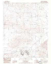
1986 Map of Fort Irwin
USGS Topo · Published 1986About this map
The Fort Irwin Military Reservation dominates this mid-1980s landscape, illustrating a specialized environment of modern defense operations and desert infrastructure. Centered on the main settlement of Fort Irwin, the map captures a specific moment of expansion with areas marked as Under Construction. Essential logistics and communication points are scattered across the terrain, including Observation Towers, a Heliport, and several Helipads.
Find a feature on this map
23 named features on this map. Tap any name to fly to it.
Don’t see what you’re looking for? This feature index may not catch every label — zoom into the map to look around manually.
Map Details
Editions of this 1986 Fort Irwin Map
3 editions found
Other maps of this area

1933 · Avawatz Mountains
USGS Topo · 1:250,000

1947 · Trona
USGS Topo · 1:250,000

1948 · Trona
USGS Topo · 1:250,000

1948 · Alvord Mountain
USGS Topo · 1:62,500

1948 · Lane Mountain
USGS Topo · 1:62,500

1948 · Goldstone Lake
USGS Topo · 1:62,500

1948 · Tiefort Mountains
USGS Topo · 1:62,500

1951 · Goldstone Lake
USGS Topo · 1:62,500

1951 · Tiefort Mountains
USGS Topo · 1:62,500

1951 · Alvord Mountain
USGS Topo · 1:62,500