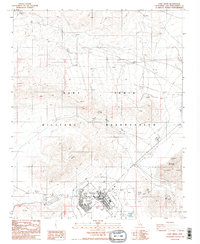
1986 Map of Fort Irwin
USGS Topo · Published 1986About this map
Fort Irwin serves as the central hub of this High Desert landscape, situated within the expansive Fort Irwin Military Reservation during the mid-1980s. The topographic detail reveals a landscape heavily modified for military training and operations, featuring a complex of Helipads, a dedicated Heliport, and various Observation Towers overlooking the arid terrain. To the east, Bicycle Lake and the adjacent Bicycle Lake Army Airfield define the lowland geography, protected by a series of Levees. The map captures the infrastructure of the base at this time, including a Sanitary Disposal Site and a Picnic Area, contrasting the functional requirements of a military installation with the natural features of Coyote Canyon. Remote 4wd tracks and a solitary Gravel Pit indicate the logistical reach across the Mojave's dry washes and ridges.
Find a feature on this map
21 named features on this map. Tap any name to fly to it.
Don’t see what you’re looking for? This feature index may not catch every label — zoom into the map to look around manually.
Map Details
Editions of this 1986 Fort Irwin Map
3 editions found
Other maps of this area

1933 · Avawatz Mountains
USGS Topo · 1:250,000

1947 · Trona
USGS Topo · 1:250,000

1948 · Trona
USGS Topo · 1:250,000

1948 · Alvord Mountain
USGS Topo · 1:62,500

1948 · Lane Mountain
USGS Topo · 1:62,500

1948 · Goldstone Lake
USGS Topo · 1:62,500

1948 · Tiefort Mountains
USGS Topo · 1:62,500

1951 · Goldstone Lake
USGS Topo · 1:62,500

1951 · Tiefort Mountains
USGS Topo · 1:62,500

1951 · Alvord Mountain
USGS Topo · 1:62,500