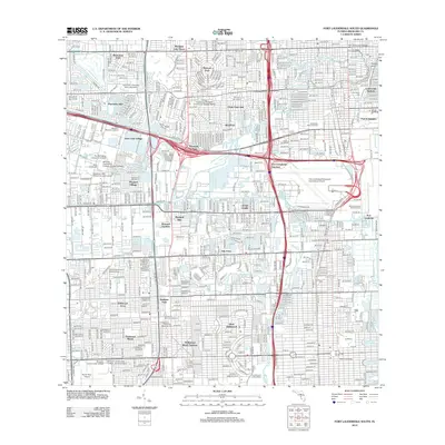
2012 Map of Fort Lauderdale South
USGS Topo · Published 2012About this map
The South Fork New River and Dania Cut-Off Canal anchor this detailed coastal landscape, which showcases the dense suburban and industrial evolution of South Florida in the early 21st century. The map highlights the significant infrastructure of Port Everglades and the massive footprint of the Fort Lauderdale/Hollywood International Airport, reflecting the region's role as a major transit hub. Diverse residential developments like Hacienda Village, Melrose Park, and Plantation Isles are tightly woven between a complex system of waterways, including Silver Lake and the North New River Canal.
Find a feature on this map
67 named features on this map. Tap any name to fly to it.
Don’t see what you’re looking for? This feature index may not catch every label — zoom into the map to look around manually.
Map Details
Editions of this 2012 Fort Lauderdale South Map
This is the sole edition of this map. No revisions or reprints were ever made.
Other maps of this area

1945 · Fort Lauderdale North
USGS Topo · 1:24,000

1947 · North Miami
USGS Topo · 1:24,000

1949 · Opalocka
USGS Topo · 1:24,000

1949 · Fort Lauderdale North
USGS Topo · 1:24,000

1949 · Port Everglades
USGS Topo · 1:24,000

1949 · Fort Lauderdale South
USGS Topo · 1:24,000

1949 · Pompano Beach
USGS Topo · 1:24,000

1950 · North Miami
USGS Topo · 1:24,000

1956 · Miami
USGS Topo · 1:250,000

1956 · West Palm Beach
USGS Topo · 1:250,000