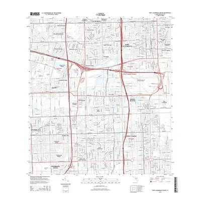
2015 Map of Fort Lauderdale South
USGS Topo · Published 2015About this map
Fort Lauderdale and its southern suburbs are defined by a complex network of waterways and industrial corridors as they appeared in 2015. The landscape is dominated by major infrastructure, including the Fort Lauderdale/Hollywood International Airport and the massive maritime hub at Port Everglades. These transportation centers are integrated into a grid of residential developments like Hacienda Village and Melrose Park, separated by the North New River Canal and the South Fork New River. The presence of institutions such as Nova Southeastern Univ and Broward Coll shows the transition from earlier agriculture toward a modern service and educational economy.
Find a feature on this map
67 named features on this map. Tap any name to fly to it.
Don’t see what you’re looking for? This feature index may not catch every label — zoom into the map to look around manually.
Map Details
Editions of this 2015 Fort Lauderdale South Map
This is the sole edition of this map. No revisions or reprints were ever made.
Other maps of this area

1945 · Fort Lauderdale North
USGS Topo · 1:24,000

1947 · North Miami
USGS Topo · 1:24,000

1949 · Opalocka
USGS Topo · 1:24,000

1949 · Fort Lauderdale North
USGS Topo · 1:24,000

1949 · Port Everglades
USGS Topo · 1:24,000

1949 · Fort Lauderdale South
USGS Topo · 1:24,000

1949 · Pompano Beach
USGS Topo · 1:24,000

1950 · North Miami
USGS Topo · 1:24,000

1956 · Miami
USGS Topo · 1:250,000

1956 · West Palm Beach
USGS Topo · 1:250,000