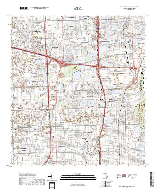
2024 Map of Fort Lauderdale South
USGS Topo · Published 2024About this map
Fort Lauderdale serves as the focal point of this modern topographic study, showcasing a dense urban and aquatic network defined by its famous canals and waterways. The map illustrates the sophisticated drainage and transit infrastructure of southern Florida, from the New River and the North New River Canal to the expansive industrial footprint of Port Everglades. Residential developments such as Chula Vista Isles, Rio Vista Isles, and Melrose Park are interwoven with significant institutional landmarks, including the Broward County Judicial Complex and multiple campuses for Broward College. This area's transition from the coastal reaches of Dania Beach to the inland neighborhoods of Davie and Pembroke Pines is bridged by massive transportation hubs like the Fort Lauderdale/Hollywood International Airport. The persistence of early planning is visible in the alignment of W Broward Blvd and the historic Tarpon Bend, reflecting the city's growth along its original river arteries.
Find a feature on this map
71 named features on this map. Tap any name to fly to it.
Don’t see what you’re looking for? This feature index may not catch every label — zoom into the map to look around manually.
Map Details
Editions of this 2024 Fort Lauderdale South Map
This is the sole edition of this map. No revisions or reprints were ever made.
Other maps of this area

1945 · Fort Lauderdale North
USGS Topo · 1:24,000

1947 · North Miami
USGS Topo · 1:24,000

1949 · Opalocka
USGS Topo · 1:24,000

1949 · Fort Lauderdale North
USGS Topo · 1:24,000

1949 · Port Everglades
USGS Topo · 1:24,000

1949 · Fort Lauderdale South
USGS Topo · 1:24,000

1949 · Pompano Beach
USGS Topo · 1:24,000

1950 · North Miami
USGS Topo · 1:24,000

1956 · Miami
USGS Topo · 1:250,000

1956 · West Palm Beach
USGS Topo · 1:250,000