
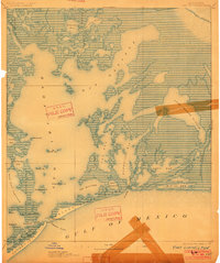
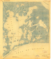
1893 Map of Fort Livingston
USGS Topo · Published 1893About this map
Ft. Livingston stands as a primary sentinel at the eastern edge of Grand Isle, guarding the entrance to the expansive Barataria Bay. Compiled by H. L. Baldwin Jr. from late 19th-century surveys, this map captures the complex labyrinth of the Louisiana coast before modern engineering significantly altered the hydrologic patterns of the Mississippi Delta. The landscape is defined by a dense network of tidal passes and lagoons, including Lake Grande Ecaille and Bay Batiste, where the transition from the Gulf of Mexico to the inland bayous is marked by scattered landforms like Queen Bess Id. and Mendicant Island. Navigation aids such as the Light at Grand Pass highlight the maritime importance of this region, providing a detailed record of the shoreline and maritime infrastructure during a period when these waterways were the essential arteries for regional trade and coastal defense.
Find a feature on this map
41 named features on this map. Tap any name to fly to it.
Don’t see what you’re looking for? This feature index may not catch every label — zoom into the map to look around manually.
Map Details
Editions of this 1893 Fort Livingston Map
3 editions found
Other maps of this area

1891 · Pointe a La Hache
USGS Topo · 1:62,500

1892 · Barataria
USGS Topo · 1:62,500

1892 · Cheniere Caminada
USGS Topo · 1:62,500

1892 · Quarantine
USGS Topo · 1:62,500

1892 · Creole
USGS Topo · 1:62,500

1892 · Pointe a La Hache
USGS Topo · 1:62,500

1893 · Dime
USGS Topo · 1:62,500

1935 · Port Sulphur
USGS Topo · 1:31,680

1935 · Bastian Bay
USGS Topo · 1:31,680

1935 · Bay Ronquille
USGS Topo · 1:31,680