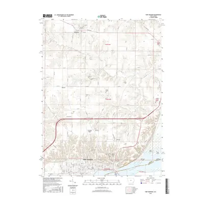
2015 Map of Fort Madison
USGS Topo · Published 2015About this map
Fort Madison dominates the southern portion of this map, situated along the northern banks of the Mississippi River and the expansive Lake Keokuk. The city's layout is defined by a rigorous grid of avenues, stretching from the riverfront up toward Denmark Hilltop. This 2015 survey reveals a significant concentration of burial sites and institutional land use, including the Iowa State Prison Cem and the Fort Madison City Cem, reflecting the town's long-established role as a regional hub. North of the city, the landscape transitions into the agricultural terrain of Lee County, where the small community of Denmark is located along Houston Ave and Academy Ave. The rural areas are marked by numerous family and community grounds, such as the Jones Cem and Mothershed Cem, interspersed among the drainage basins of Lost Cr and Devil Cr.
Find a feature on this map
82 named features on this map. Tap any name to fly to it.
Don’t see what you’re looking for? This feature index may not catch every label — zoom into the map to look around manually.
Map Details
Editions of this 2015 Fort Madison Map
This is the sole edition of this map. No revisions or reprints were ever made.
Other maps of this area

1932 · Lomax
USGS Topo · 1:62,500

1934 · Burlington
USGS Topo · 1:48,000

1936 · Fort Madison
USGS Topo · 1:62,500

1937 · Lomax
USGS Topo · 1:62,500

1940 · Burlington
USGS Topo · 1:62,500

1958 · Burlington
USGS Topo · 1:250,000

1961 · Burlington
USGS Topo · 1:250,000

1963 · Burlington
USGS Topo · 1:250,000
1964 · Nauvoo
USGS Topo · 1:24,000

1964 · West Point
USGS Topo · 1:24,000