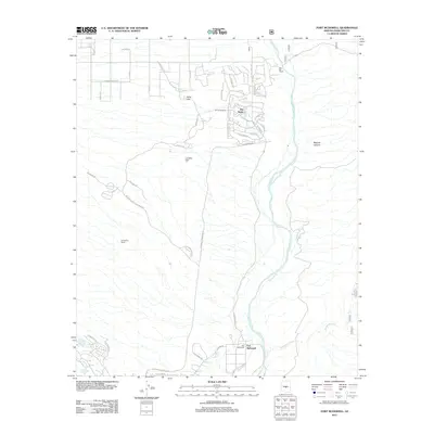
2011 Map of Fort McDowell
USGS Topo · Published 2011About this map
The Verde River serves as the central artery for this Maricopa County landscape, where the riparian corridor meets the expanding residential and ranching footprints of the early 21st century. The map centers on the historic Fort McDowell area, illustrating a transition from traditional land use at Box Bar Ranch and Pemberton Ranch to more modern developments like Rio Verde and Rio Verde Estate. These settlements are framed by prominent local landforms, including the Asher Hills and Lousley Hill to the west, and the sharp descent into Malpais Canyon to the east. A complex network of roads, such as E Rio Verde Dr and McDowell Mountain Rd, reflects the suburban growth moving northward from Fountain Hills. The eastern half of the map remains largely dominated by the river's winding path and the confluence with Sycamore Creek, highlighting the importance of water sources in this desert environment.
Find a feature on this map
43 named features on this map. Tap any name to fly to it.
Don’t see what you’re looking for? This feature index may not catch every label — zoom into the map to look around manually.
Map Details
Editions of this 2011 Fort McDowell Map
This is the sole edition of this map. No revisions or reprints were ever made.
Other maps of this area

1904 · Camelback
USGS Topo · 1:62,500

1904 · Ft. McDowell
USGS Topo · 1:62,500

1906 · Camelsback
USGS Topo · 1:62,500

1906 · Ft. McDowell
USGS Topo · 1:62,500

1930 · Cave Creek
USGS Topo · 1:125,000

1939 · Cave Creek
USGS Topo · 1:125,000

1954 · Mesa
USGS Topo · 1:250,000

1957 · Mesa
USGS Topo · 1:250,000

1958 · Mesa
USGS Topo · 1:250,000

1960 · Mesa
USGS Topo · 1:250,000