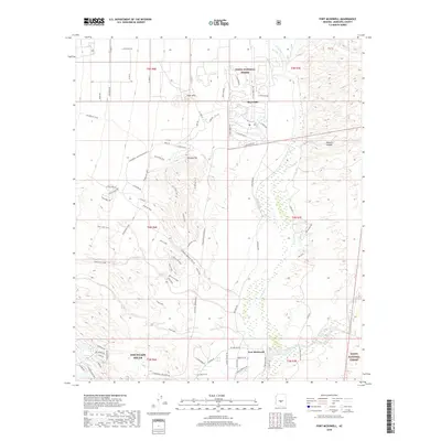
2018 Map of Fort McDowell
USGS Topo · Published 2018About this map
Fort McDowell and the northern reaches of Fountain Hills occupy a landscape defined by the winding course of the Verde River as it flows south through the Tonto National Forest. This 2018 survey details a region where modern suburban developments like Rio Verde meet the high-relief terrain of the Asher Hills and Lousley Hill. The map meticulously documents a sophisticated network of recreational paths, including the Pemberton Loop, Escondido Trail, and Tonto Tank Trail, which traverse the desert washes and ridgelines. Near the river, historical water management is visible through features like Jones Ditch, while the natural drainage of Sycamore Cr and Shallmo Wash cuts through the eastern canyons. The contrast between the grid-based residential expansion in the northwest and the protected wilderness areas to the east illustrates the late-20th and early-21s-century growth patterns of the Phoenix metropolitan fringe.
Find a feature on this map
71 named features on this map. Tap any name to fly to it.
Don’t see what you’re looking for? This feature index may not catch every label — zoom into the map to look around manually.
Map Details
Editions of this 2018 Fort McDowell Map
This is the sole edition of this map. No revisions or reprints were ever made.
Other maps of this area

1904 · Camelback
USGS Topo · 1:62,500

1904 · Ft. McDowell
USGS Topo · 1:62,500

1906 · Camelsback
USGS Topo · 1:62,500

1906 · Ft. McDowell
USGS Topo · 1:62,500

1930 · Cave Creek
USGS Topo · 1:125,000

1939 · Cave Creek
USGS Topo · 1:125,000

1954 · Mesa
USGS Topo · 1:250,000

1957 · Mesa
USGS Topo · 1:250,000

1958 · Mesa
USGS Topo · 1:250,000

1960 · Mesa
USGS Topo · 1:250,000