1971 Map of Fort McDowell
USGS Topo · Published 1972About this map
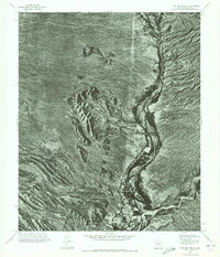
Fort McDowell stands as a primary point of interest in this orthophotoquad, situated along the western banks of the Verde River. Captured through photogrammetric methods in the early 1970s, the imagery reveals the sharp contrast between the riparian corridor and the arid landscape of the surrounding Sonoran Desert. The settlement pattern at the fort is clearly visible against the meandering river, which serves as the dominant geographical feature of the region. To the northwest, Lousley Hill rises from the desert floor, providing a distinct landmark within the varied terrain. The inclusion of Sycamore to the south further defines the local geography. This specific type of aerial survey allows for a precise visual record of land use and vegetation density during a period of transition for Maricopa County, documenting the state of the valley before further modern development altered the river's immediate surroundings.
Find a feature on this map
4 named features on this map. Tap any name to fly to it.
Don’t see what you’re looking for? This feature index may not catch every label — zoom into the map to look around manually.
Map Details
Editions of this 1971 Fort McDowell Map
This is the sole edition of this map. No revisions or reprints were ever made.
Other maps of this area

1904 · Camelback
USGS Topo · 1:62,500

1904 · Ft. McDowell
USGS Topo · 1:62,500

1906 · Camelsback
USGS Topo · 1:62,500

1906 · Ft. McDowell
USGS Topo · 1:62,500

1930 · Cave Creek
USGS Topo · 1:125,000

1939 · Cave Creek
USGS Topo · 1:125,000

1954 · Mesa
USGS Topo · 1:250,000

1957 · Mesa
USGS Topo · 1:250,000

1958 · Mesa
USGS Topo · 1:250,000

1960 · Mesa
USGS Topo · 1:250,000