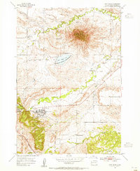
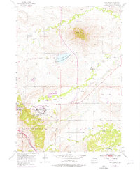
1953 Map of Fort Meade
USGS Topo · Published 1955About this map
Bear Butte dominates the northern skyline of this 1950s survey, rising sharply above the surrounding plains and the Bear Butte National Wildlife Refuge. To the south, the landscape is defined by the expansive Fort Meade Military Reservation, where the historic post of Fort Meade serves as a central hub alongside a Veterans Hospital. The intersection of military history and early education is evident in the scattered rural schools, such as Hamm Sch and Spring Creek Sch, which served the outlying ranching communities during this era.
Find a feature on this map
20 named features on this map. Tap any name to fly to it.
Don’t see what you’re looking for? This feature index may not catch every label — zoom into the map to look around manually.
Map Details
Editions of this 1953 Fort Meade Map
5 editions found
Other maps of this area

1893 · Rapid
USGS Topo · 1:125,000

1894 · Deadwood
USGS Topo · 1:125,000

1898 · Rapid
USGS Topo · 1:125,000

1899 · Sturgis
USGS Topo · 1:62,500

1901 · Deadwood
USGS Topo · 1:125,000

1903 · Rapid
USGS Topo · 1:125,000

1905 · Saint Onge
USGS Topo · 1:62,500

1906 · Vale
USGS Topo · 1:62,500

1907 · Belle Fourche
USGS Topo · 1:125,000

1913 · Newell
USGS Topo · 1:125,000