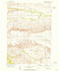
1953 Map of Fort Meade NE
USGS Topo · Published 1955About this map
Bear Butte stands as a prominent geological anchor in this mid-century topographic survey of Meade County. The landscape is defined by the winding paths of Spring Creek, Bear Butte Creek, Cottle Creek, and Alkali Creek, which carve through the terrain and dictate the placement of early rural infrastructure. Local community life during this era is centered around small educational hubs like Wilson Sch and Laurel Sch, while the Alkali Club House and a Gravel Pit suggest the social and industrial activity of the period. This map captures the region's transition as the Alkali Road network provided essential connectivity across the drainage basins of the Black Hills foothills before more modern development altered the rural footprint.
Find a feature on this map
9 named features on this map. Tap any name to fly to it.
Don’t see what you’re looking for? This feature index may not catch every label — zoom into the map to look around manually.
Map Details
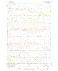
Editions of this 1953 Fort Meade NE Map
2 editions found
Other maps of this area

1893 · Rapid
USGS Topo · 1:125,000

1898 · Rapid
USGS Topo · 1:125,000

1903 · Rapid
USGS Topo · 1:125,000

1906 · Vale
USGS Topo · 1:62,500

1913 · Newell
USGS Topo · 1:125,000

1951 · Volunteer
USGS Topo · 1:24,000

1951 · Vale
USGS Topo · 1:24,000

1951 · Vale SE
USGS Topo · 1:24,000

1951 · Vale
USGS Topo · 1:62,500

1953 · Rapid City 1 SW
USGS Topo · 1:24,000