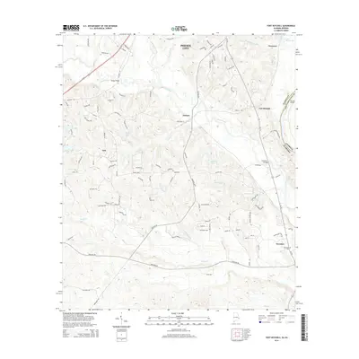
2014 Map of Fort Mitchell
USGS Topo · Published 2014About this map
Fort Mitchell sits at the edge of the Chattahoochee County line, marking a landscape defined by the winding course of Uchee Creek and its many tributaries. In this corner of Russell County, the map reveals a pattern of dispersed settlements such as Lato, Nuckols, and Oswichee, each connected by a network of rural roads and bridges including Youngs Bridge and Nuckols Bridge. The terrain is deeply etched by water, with Broken Arrow Cr, Little Uchee Creek, and Ihagee Cr creating a complex system of ridges and valleys. Evidence of long-standing local community is found at Oswichee Cem, while more modern development is seen in the southern expansion of Phenix City. The presence of several small water bodies, such as Spiders Lake, Mott Lake, and Bradleys Pond, suggests a legacy of local agricultural and recreational land use tied to the region's hydrology.
Find a feature on this map
104 named features on this map. Tap any name to fly to it.
Don’t see what you’re looking for? This feature index may not catch every label — zoom into the map to look around manually.
Map Details
Editions of this 2014 Fort Mitchell Map
This is the sole edition of this map. No revisions or reprints were ever made.
Other maps of this area

1908 · Columbus
USGS Topo · 1:62,500

1914 · Seale
USGS Topo · 1:62,500

1929 · Columbus
USGS Topo · 1:48,000

1947 · Columbus
USGS Topo · 1:62,500

1949 · Fort Mitchell
USGS Topo · 1:24,000

1949 · Julia
USGS Topo · 1:24,000

1949 · Columbus
USGS Topo · 1:24,000

1950 · Fort Benning
USGS Topo · 1:24,000

1950 · Crawford
USGS Topo · 1:24,000

1950 · Seale
USGS Topo · 1:24,000