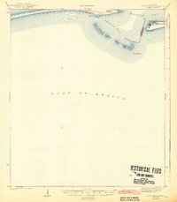
1942 Map of Fort Morgan
USGS Topo · Published 1942About this map
Fort Morgan stands as the primary sentry over the entrance to Mobile Bay in this wartime-era survey. Across the Main Channel, the Fort Gaines Ruins mark the eastern tip of Dauphin Island, highlighting the strategic coastal defenses guarding the passage between the bay and the Gulf of Mexico. The shifting sands of the coast are documented in the contours of Pelican Island and the sand dunes near East Point. This maritime landscape is defined by its navigational hazards and aids, including the Sand Island LH and the narrow Pelican Passage. The map delineates the aqueous boundary between Mobile Co and Baldwin Co, capturing the coastal geomorphology of Mobile Point and its surrounding shoals before mid-century changes altered the shoreline.
Find a feature on this map
17 named features on this map. Tap any name to fly to it.
Don’t see what you’re looking for? This feature index may not catch every label — zoom into the map to look around manually.
Map Details
Editions of this 1942 Fort Morgan Map
3 editions found
Other maps of this area

1921 · Grand Bay
USGS Topo · 1:62,500

1921 · Petit Bois Island
USGS Topo · 1:62,500

1921 · Point Clear
USGS Topo · 1:62,500

1921 · Dauphin Island
USGS Topo · 1:62,500

1921 · Delchamps
USGS Topo · 1:62,500

1941 · Cedar Point
USGS Topo · 1:62,500

1941 · Weeks Bay
USGS Topo · 1:62,500

1942 · Petit Bois Island
USGS Topo · 1:62,500

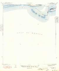
1942 · Fort Morgan
USGS Topo · 1:62,500

1943 · Cedar Point
USGS Topo · 1:62,500