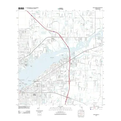
2012 Map of Fort Myers
USGS Topo · Published 2012About this map
The Caloosahatchee River serves as the central artery for this part of Southwest Florida, widening as it flows past Fort Myers and East Fort Myers. The river is punctuated by prominent landforms such as Beautiful Island, Midway Island, and the notably named Buzzard Roost. Infrastructure in the early 21st century is defined by the heavy presence of I-75 and several key river crossings, including the Edison Bridge and the Wilson Pigott Bridge.
Find a feature on this map
38 named features on this map. Tap any name to fly to it.
Don’t see what you’re looking for? This feature index may not catch every label — zoom into the map to look around manually.
Map Details
Editions of this 2012 Fort Myers Map
This is the sole edition of this map. No revisions or reprints were ever made.
Other maps of this area

1956 · Telegraph Swamp
USGS Topo · 1:24,000

1956 · West Palm Beach
USGS Topo · 1:250,000

1957 · West Palm Beach
USGS Topo · 1:250,000

1957 · Tuckers Corner
USGS Topo · 1:24,000

1957 · Gilchrist
USGS Topo · 1:24,000

1958 · West Palm Beach
USGS Topo · 1:250,000

1958 · Fort Myers NW
USGS Topo · 1:24,000

1958 · Fort Myers SW
USGS Topo · 1:24,000

1958 · Olga
USGS Topo · 1:24,000

1958 · Alva SW
USGS Topo · 1:24,000