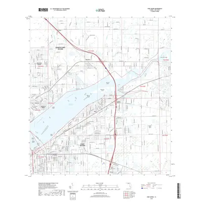
2018 Map of Fort Myers
USGS Topo · Published 2018About this map
The Caloosahatchee River serves as the dominant geographic spine for this area of Southwest Florida, separating North Fort Myers from the city proper. This modern survey illustrates the intensive residential development and transportation infrastructure surrounding the Okeechobee Waterway, featuring numerous named islands such as Beautiful Island and Midway Island. The map provides significant detail for local historians, documenting the exact locations of the Fort Myers Cem Oak Ridge and the Hendry-Frierson Cem. The presence of the Seaboard St rail corridor and educational institutions like Keiser Univ Ft Myers Campus and Rasmussen College-Fort Myers highlights the region's urban evolution. To the north and east, more rural elements remain, including the Strayhorn Ranch Airport and the winding course of the Orange River.
Find a feature on this map
115 named features on this map. Tap any name to fly to it.
Don’t see what you’re looking for? This feature index may not catch every label — zoom into the map to look around manually.
Map Details
Editions of this 2018 Fort Myers Map
This is the sole edition of this map. No revisions or reprints were ever made.
Other maps of this area

1956 · Telegraph Swamp
USGS Topo · 1:24,000

1956 · West Palm Beach
USGS Topo · 1:250,000

1957 · West Palm Beach
USGS Topo · 1:250,000

1957 · Tuckers Corner
USGS Topo · 1:24,000

1957 · Gilchrist
USGS Topo · 1:24,000

1958 · West Palm Beach
USGS Topo · 1:250,000

1958 · Fort Myers NW
USGS Topo · 1:24,000

1958 · Fort Myers SW
USGS Topo · 1:24,000

1958 · Olga
USGS Topo · 1:24,000

1958 · Alva SW
USGS Topo · 1:24,000