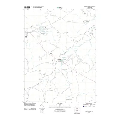
2010 Map of Fort Necessity
USGS Topo · Published 2010About this map
Farmington and Chalkhill anchor this high-elevation landscape in the Laurel Highlands as it appeared in 2010. The terrain is defined by a dense network of mountain streams and glades, including Meadow Run, Big Sandy Creek, and Noahs Glade, which feed a series of small mountain lakes like Deer Lake and Lake George. The map preserves the names of numerous small family cemeteries, such as Sunsetview Cemetery, Spear Cemetery, and Workman Cemetery, which offer valuable data for genealogists tracing local lineage in Wharton Township. Modern aviation is represented by Nemacolin Airport and the Hager Airstrip, while historical landmarks like Kentuck Knob and the Heritage Reservation Dam suggest the area's transition into a center for recreation and architectural significance near the turn of the 21st century.
Find a feature on this map
81 named features on this map. Tap any name to fly to it.
Don’t see what you’re looking for? This feature index may not catch every label — zoom into the map to look around manually.
Map Details
Editions of this 2010 Fort Necessity Map
This is the sole edition of this map. No revisions or reprints were ever made.
Other maps of this area

1900 · Accident
USGS Topo · 1:62,500

1900 · Uniontown
USGS Topo · 1:62,500

1904 · Bruceton
USGS Topo · 1:62,500

1922 · Confluence
USGS Topo · 1:62,500

1926 · Bruceton
USGS Topo · 1:62,500

1931 · Uniontown
USGS Topo · 1:62,500

1931 · Confluence
USGS Topo · 1:62,500

1931 · Bruceton Mills
USGS Topo · 1:62,500

1933 · Confluence
USGS Topo · 1:62,500

1933 · Bruceton
USGS Topo · 1:62,500
Featured Places
- Farmington, Wharton Township
- Chalkhill, Wharton Township
- North Union Township, PA
- Henry Clay Township, PA
- Wharton Township, PA