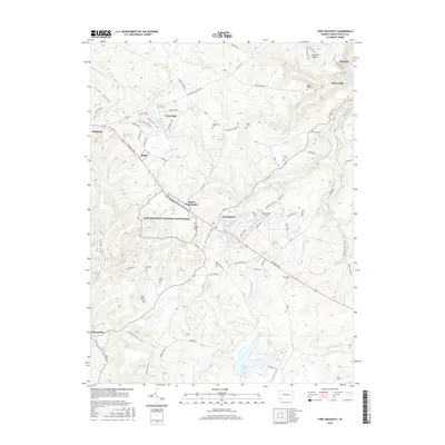
2016 Map of Fort Necessity
USGS Topo · Published 2016About this map
Fort Necessity National Battlefield dominates this landscape in Fayette County, marking a site of immense consequence for colonial North American history. The area around Farmington and Mount Washington is shaped by the legacy of early western expansion, with the National Pike and historic routes like the Lafayette Trl and William Penn Trl cutting through the highlands. The geography is characterized by numerous small mountain lakes and ponds, including Heritage Lake, Deer Lake, and Surprise Lake, which feed the drainages of Cucumber Run and Stony Fork.
Find a feature on this map
102 named features on this map. Tap any name to fly to it.
Don’t see what you’re looking for? This feature index may not catch every label — zoom into the map to look around manually.
Map Details
Editions of this 2016 Fort Necessity Map
This is the sole edition of this map. No revisions or reprints were ever made.
Other maps of this area

1900 · Accident
USGS Topo · 1:62,500

1900 · Uniontown
USGS Topo · 1:62,500

1904 · Bruceton
USGS Topo · 1:62,500

1922 · Confluence
USGS Topo · 1:62,500

1926 · Bruceton
USGS Topo · 1:62,500

1931 · Uniontown
USGS Topo · 1:62,500

1931 · Confluence
USGS Topo · 1:62,500

1931 · Bruceton Mills
USGS Topo · 1:62,500

1933 · Confluence
USGS Topo · 1:62,500

1933 · Bruceton
USGS Topo · 1:62,500
Featured Places
- Farmington, Wharton Township
- Chalkhill, Wharton Township
- North Union Township, PA
- Henry Clay Township, PA
- Wharton Township, PA