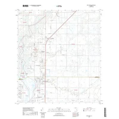
2018 Map of Fort Ogden
USGS Topo · Published 2018About this map
The Peace River carves a winding path through this Southwest Florida landscape, defining the character of small riverine settlements near the Desoto and Charlotte County line. The community of Fort Ogden stands as a focal point, supported by surrounding hamlets like Hull, Southfort, and Morgantown. This survey illustrates the intricate relationship between the river’s hydrology and local development, showing how residential areas like Peace River Shores are situated relative to wetlands and smaller tributaries such as Hunter Creek and Thornton Br.
Find a feature on this map
117 named features on this map. Tap any name to fly to it.
Don’t see what you’re looking for? This feature index may not catch every label — zoom into the map to look around manually.
Map Details
Editions of this 2018 Fort Ogden Map
This is the sole edition of this map. No revisions or reprints were ever made.
Other maps of this area

1956 · Arcadia SE
USGS Topo · 1:24,000

1956 · Murdock SE
USGS Topo · 1:24,000

1956 · Murdock NE
USGS Topo · 1:24,000

1956 · Cleveland
USGS Topo · 1:24,000

1956 · Ft. Ogden
USGS Topo · 1:24,000

1956 · Nocatee
USGS Topo · 1:24,000

1956 · Bermont
USGS Topo · 1:24,000

1956 · West Palm Beach
USGS Topo · 1:250,000

1956 · Tampa
USGS Topo · 1:250,000

1956 · Fort Pierce
USGS Topo · 1:250,000