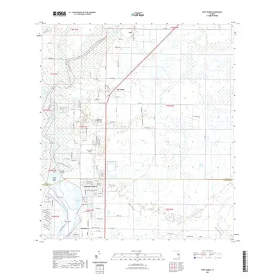
2021 Map of Fort Ogden
USGS Topo · Published 2021About this map
The Peace River carves a winding path through the heart of this Florida landscape, defining a corridor of wetlands and islands like Liverpool Island and Cow Island. Along its eastern banks, the small settlement of Fort Ogden serves as a local center, marked by the Fort Ogden Cem and proximity to the Sunnybreeze Airport. The region's geography is heavily influenced by its water systems, including the substantial Lettuce Lake and English Lake, as well as numerous tributaries such as Boggess Creek and Thornton Br. Residential developments such as Peace River Shores and Morgantown are situated near the boundary between DeSoto and Charlotte counties. Further north, the Peace River State Trl follows the old rail corridor through Hull, passing the Hull Cem near the upper reaches of the river valley.
Find a feature on this map
75 named features on this map. Tap any name to fly to it.
Don’t see what you’re looking for? This feature index may not catch every label — zoom into the map to look around manually.
Map Details
Editions of this 2021 Fort Ogden Map
This is the sole edition of this map. No revisions or reprints were ever made.
Other maps of this area

1956 · Arcadia SE
USGS Topo · 1:24,000

1956 · Murdock SE
USGS Topo · 1:24,000

1956 · Murdock NE
USGS Topo · 1:24,000

1956 · Cleveland
USGS Topo · 1:24,000

1956 · Ft. Ogden
USGS Topo · 1:24,000

1956 · Nocatee
USGS Topo · 1:24,000

1956 · Bermont
USGS Topo · 1:24,000

1956 · West Palm Beach
USGS Topo · 1:250,000

1956 · Tampa
USGS Topo · 1:250,000

1956 · Fort Pierce
USGS Topo · 1:250,000