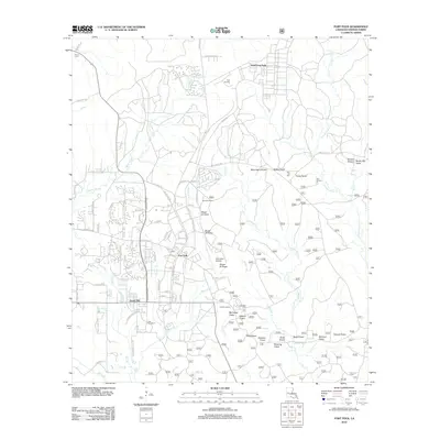
2012 Map of Fort Polk
USGS Topo · Published 2012About this map
Fort Polk serves as the focal point of this 2012 military landscape in Vernon Parish, where the complex infrastructure of a major army installation is mapped alongside the winding tributaries of the Whisky Chitto Cr. The base layout is defined by a dense network of roads, ranging from residential areas like North Fort Polk and Sandy Hill to specialized military sites including Polk Army Airfield. A series of training ranges and observation points, such as Range 29 Tower and Pershing Tower, are situated among the watersheds of Bundick Cr and Bayou Zourie.
Find a feature on this map
90 named features on this map. Tap any name to fly to it.
Don’t see what you’re looking for? This feature index may not catch every label — zoom into the map to look around manually.
Map Details
Editions of this 2012 Fort Polk Map
This is the sole edition of this map. No revisions or reprints were ever made.
Other maps of this area

1941 · Leesville
USGS Topo · 1:62,500

1941 · Slagle
USGS Topo · 1:62,500

1943 · Leesville
USGS Topo · 1:62,500

1944 · Slagle
USGS Topo · 1:62,500

1946 · Leesville
USGS Topo · 1:62,500

1947 · Rosepine
USGS Topo · 1:31,680

1947 · Chasmore
USGS Topo · 1:31,680

1947 · Sugrue
USGS Topo · 1:31,680

1948 · Leesville
USGS Topo · 1:62,500

1952 · Lake Charles
USGS Topo · 1:250,000
Featured Places
- North Fort Polk, LA
- Fort Johnson South, LA
- Sandy Hill, LA
- Fort Polk, Fort Johnson South
- Vernon Parish, LA