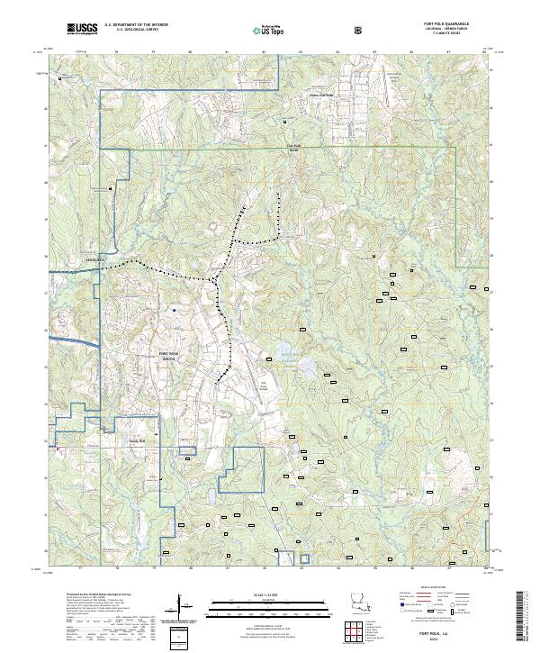
2024 Map of Fort Polk
USGS Topo · Published 2024About this map
Kisatchie National Forest and the vast military installations of Fort Polk dominate this Vernon Parish landscape. The transition from the urban fringes of Leesville to the structured grids of Fort Polk South and North Fort Polk reveals the deep integration of the local community with the military presence. Aviation infrastructure is centered at Polk Army Airfield, while the surrounding terrain is defined by a dense network of waterways including Whisky Chitto Creek, Bundick Creek, and Drakes Creek.
Find a feature on this map
118 named features on this map. Tap any name to fly to it.
Don’t see what you’re looking for? This feature index may not catch every label — zoom into the map to look around manually.
Map Details
Editions of this 2024 Fort Polk Map
This is the sole edition of this map. No revisions or reprints were ever made.
Other maps of this area

1941 · Leesville
USGS Topo · 1:62,500

1941 · Slagle
USGS Topo · 1:62,500

1943 · Leesville
USGS Topo · 1:62,500

1944 · Slagle
USGS Topo · 1:62,500

1946 · Leesville
USGS Topo · 1:62,500

1947 · Rosepine
USGS Topo · 1:31,680

1947 · Chasmore
USGS Topo · 1:31,680

1947 · Sugrue
USGS Topo · 1:31,680

1948 · Leesville
USGS Topo · 1:62,500

1952 · Lake Charles
USGS Topo · 1:250,000
Featured Places
- Sandy Hill, LA
- North Fort Polk, LA
- Fort Johnson South, LA
- Fort Polk, Fort Johnson South
- Vernon Parish, LA