
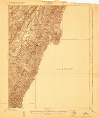
1922 Map of Fort Seybert
USGS Topo · Published 1922About this map
Fort Seybert and Brandywine anchor this 1922 preliminary survey of the South Fork Valley, documenting the rural character of Pendleton County before modernization. The landscape is defined by the steep ridges of South Fork Mountain and Shenandoah Mountain, where a dense network of one-room schoolhouses like Egypt School, Deer Run School, and Mt Zion School served isolated family farmsteads.
Find a feature on this map
73 named features on this map. Tap any name to fly to it.
Don’t see what you’re looking for? This feature index may not catch every label — zoom into the map to look around manually.
Map Details
Editions of this 1922 Fort Seybert Map
2 editions found
Other maps of this area

1892 · Franklin
USGS Topo · 1:125,000

1892 · Woodstock
USGS Topo · 1:125,000

1892 · Harrisonburg
USGS Topo · 1:125,000

1894 · Staunton
USGS Topo · 1:125,000

1896 · Franklin
USGS Topo · 1:125,000

1920 · Petersburg
USGS Topo · 1:48,000

1920 · Onego
USGS Topo · 1:62,500

1921 · Orkney Springs
USGS Topo · 1:48,000

1921 · Petersburg
USGS Topo · 1:48,000

1921 · Onego
USGS Topo · 1:48,000