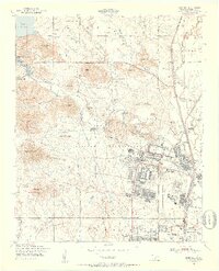
1949 Map of Fort Sill
USGS Topo · Published 1953About this map
Medicine Park sits at the edge of the granite hills and the Lake Lawtonka shoreline, serving as a distinct resort and residential pocket adjacent to the massive Fort Sill Military Reservation. This mid-century landscape is defined by the heavy presence of the United States Army, with the sprawling infrastructure of Fort Sill featuring its own Post Office, Post Chapel, and Post Cemetery. The map captures a transition from the structured military cantonment to the surrounding agricultural and tribal lands, evidenced by the Fort Sill Indian School and the Mt Scott Comanche Mission to the north.
Find a feature on this map
92 named features on this map. Tap any name to fly to it.
Don’t see what you’re looking for? This feature index may not catch every label — zoom into the map to look around manually.
Map Details
Editions of this 1949 Fort Sill Map
2 editions found
Other maps of this area

1937 · Cache
USGS Topo · 1:48,000

1942 · Cache
USGS Topo · 1:62,500

1946 · Lawton
USGS Topo · 1:62,500

1949 · Mount Scott
USGS Topo · 1:24,000

1949 · Arbuckle Hill
USGS Topo · 1:24,000

1949 · Elgin
USGS Topo · 1:24,000

1949 · Fort Sill
USGS Topo · 1:24,000

1950 · Saddle Mountain
USGS Topo · 1:62,500

1955 · Lawton
USGS Topo · 1:250,000

1956 · Ninemile Creek
USGS Topo · 1:24,000