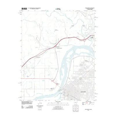
2011 Map of Fort Smith
USGS Topo · Published 2011About this map
The Arkansas River and Poteau River confluence anchors this 2011 survey, marking the strategic borderlands where Fort Smith and West Fort Smith overlook the river valley. The map documents a landscape deeply connected to national history, featuring the Trail of Tears National Historic Trail Overlook and the Fort Smith National Cemetery. Residential and commercial growth is evident in neighborhoods like Oak Park and settlements such as Van Buren, while industry persists at the Greenwood Junction Gas Field.
Find a feature on this map
88 named features on this map. Tap any name to fly to it.
Don’t see what you’re looking for? This feature index may not catch every label — zoom into the map to look around manually.
Map Details
Editions of this 2011 Fort Smith Map
This is the sole edition of this map. No revisions or reprints were ever made.
Other maps of this area

1879 · Fort Smith
USGS Topo · 1:62,500

1887 · Van Buren
USGS Topo · 1:62,500

1890 · Fort Smith
USGS Topo · 1:125,000

1898 · Winslow #3
USGS Topo · 1:62,500

1898 · Tahlequah
USGS Topo · 1:125,000

1898 · Winslow
USGS Topo · 1:125,000

1900 · Sallisaw
USGS Topo · 1:125,000

1901 · Winslow
USGS Topo · 1:125,000

1901 · Tahlequah
USGS Topo · 1:125,000

1905 · Tahlequah
USGS Topo · 1:125,000