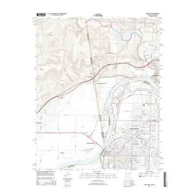
2014 Map of Fort Smith
USGS Topo · Published 2014About this map
The Arkansas River and Poteau River define the core of this 2014 survey, marking the intersection of Arkansas and Oklahoma. The historic heart of Fort Smith is anchored by the Fort Smith National Historic Site and Belle Point, showing the transition from early frontier outpost to a modern regional center. Across the river in Oklahoma, the town of Moffett and the industrial corridors of West Fort Smith contrast with the rugged terrain of the Saddleback Road area.
Find a feature on this map
100 named features on this map. Tap any name to fly to it.
Don’t see what you’re looking for? This feature index may not catch every label — zoom into the map to look around manually.
Map Details
Editions of this 2014 Fort Smith Map
This is the sole edition of this map. No revisions or reprints were ever made.
Other maps of this area

1879 · Fort Smith
USGS Topo · 1:62,500

1887 · Van Buren
USGS Topo · 1:62,500

1890 · Fort Smith
USGS Topo · 1:125,000

1898 · Winslow #3
USGS Topo · 1:62,500

1898 · Tahlequah
USGS Topo · 1:125,000

1898 · Winslow
USGS Topo · 1:125,000

1900 · Sallisaw
USGS Topo · 1:125,000

1901 · Winslow
USGS Topo · 1:125,000

1901 · Tahlequah
USGS Topo · 1:125,000

1905 · Tahlequah
USGS Topo · 1:125,000