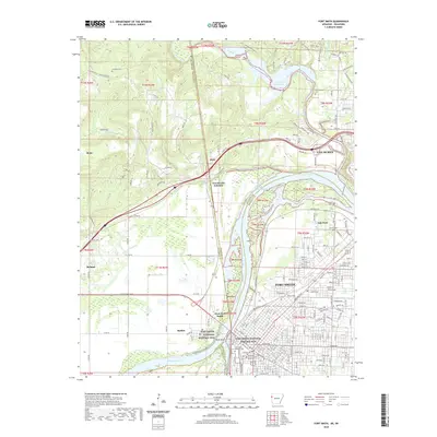
2020 Map of Fort Smith
USGS Topo · Published 2020About this map
Fort Smith and Van Buren anchor this interstate landscape where the Arkansas River meets the Poteau River at the border of Oklahoma and Arkansas. The map details the historic core of the region, specifically at Belle Point and the Fort Smith National Historic Site, marking the early frontier presence in the Arkansas Territory. The river's influence is evident in the complex hydrography of the Shoofly Bend Cutoff and the Lee Creek Reservoir to the north.
Find a feature on this map
206 named features on this map. Tap any name to fly to it.
Don’t see what you’re looking for? This feature index may not catch every label — zoom into the map to look around manually.
Map Details
Editions of this 2020 Fort Smith Map
This is the sole edition of this map. No revisions or reprints were ever made.
Other maps of this area

1879 · Fort Smith
USGS Topo · 1:62,500

1887 · Van Buren
USGS Topo · 1:62,500

1890 · Fort Smith
USGS Topo · 1:125,000

1898 · Winslow #3
USGS Topo · 1:62,500

1898 · Tahlequah
USGS Topo · 1:125,000

1898 · Winslow
USGS Topo · 1:125,000

1900 · Sallisaw
USGS Topo · 1:125,000

1901 · Winslow
USGS Topo · 1:125,000

1901 · Tahlequah
USGS Topo · 1:125,000

1905 · Tahlequah
USGS Topo · 1:125,000