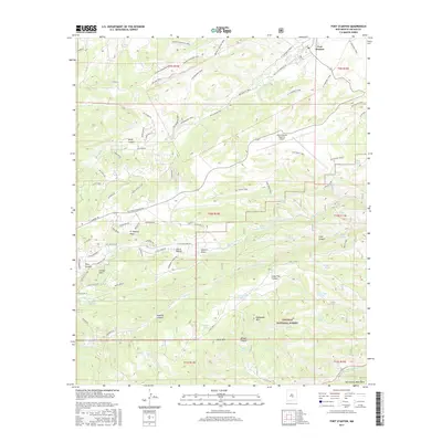
2017 Map of Fort Stanton
USGS Topo · Published 2017About this map
Fort Stanton serves as the focal point of this landscape, positioned north of the Sierra Blanca Regional Airport where high-desert mesas meet the foothills. The area is defined by a dense network of historically named routes, such as the Buffalo Soldier Trail and Black Jack Pershing Rd, which traverse the northern ridges overlooking Rio Bonito. This territory includes a portion of the Lincoln National Forest, characterized by numerous drainage systems and water tanks essential for land management, including W-Silver Tank and Lone Pine Tank. To the west, the residential development of Lincoln Hills sits adjacent to the wide expanse of Fort Stanton Mesa. Further south, the terrain descends toward Eagle Cr and the Sacramento Mountains, where the Rio Ruidoso cuts through the lower reaches of the quadrangle. Significant archaeological or historical sites are hinted at by the Petroglyph Trail, highlighting the long human presence in these canyons.
Find a feature on this map
90 named features on this map. Tap any name to fly to it.
Don’t see what you’re looking for? This feature index may not catch every label — zoom into the map to look around manually.
Map Details
Editions of this 2017 Fort Stanton Map
This is the sole edition of this map. No revisions or reprints were ever made.
Other maps of this area

1934 · Capitan
USGS Topo · 1:48,000

1935 · Capitan Mountains
USGS Topo · 1:48,000

1937 · Capitan
USGS Topo · 1:62,500

1940 · Capitan Mountains
USGS Topo · 1:62,500

1955 · Roswell
USGS Topo · 1:250,000

1958 · Roswell
USGS Topo · 1:250,000

1961 · Lincoln
USGS Topo · 1:62,500

1962 · Roswell
USGS Topo · 1:250,000

1963 · Fort Stanton
USGS Topo · 1:24,000

1963 · Ruidoso Downs
USGS Topo · 1:24,000