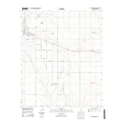
2013 Map of Fort Sumner East
USGS Topo · Published 2013About this map
The Pecos River carves through the landscape of De Baca County, anchoring the irrigation-dependent agriculture of the Fort-Sumner Valley. This region is defined by the extensive Fort Sumner Main Canal system, which redirects water to the surrounding fields and settlements. To the north, Fort Sumner serves as the primary hub, with its grid of streets such as E Main St and E Sumner Ave leading toward the Fort Sumner Municipal Airport.
Find a feature on this map
65 named features on this map. Tap any name to fly to it.
Don’t see what you’re looking for? This feature index may not catch every label — zoom into the map to look around manually.
Map Details
Editions of this 2013 Fort Sumner East Map
This is the sole edition of this map. No revisions or reprints were ever made.
Other maps of this area

1954 · Fort Sumner
USGS Topo · 1:250,000

1958 · Fort Sumner
USGS Topo · 1:250,000

1965 · Fort Sumner West
USGS Topo · 1:24,000

1965 · Windmill Draw
USGS Topo · 1:24,000

1966 · Alamo Ranch
USGS Topo · 1:24,000

1968 · Lomas Gatos
USGS Topo · 1:24,000

1968 · Fort Sumner East
USGS Topo · 1:24,000

1968 · Candy Mesa
USGS Topo · 1:24,000

1968 · Taiban
USGS Topo · 1:24,000

1968 · Bonner Lake
USGS Topo · 1:24,000