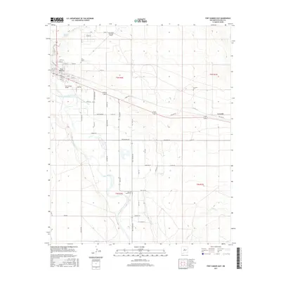
2017 Map of Fort Sumner East
USGS Topo · Published 2017About this map
The Pecos River carves a path through the landscape east of Fort Sumner, where a network of modern roads and historical landmarks define the terrain. This desert valley is marked by its vital water systems, including the Fort Sumner Main Canal and Sunnyside Springs, which supported the development of Fort Sumner Valley and nearby La Lande. Genealogical interest is anchored by three distinct burial grounds: the Fort Sumner Cem, the La Lande Cem further east, and the Old Fort Sumner Cem situated to the south near the river. This latter site, accessed via Billy the Kid Rd, is deeply tied to the history of the legendary figure whose name marks several thoroughfares in the area, including Pat Garrett Dr. The map illustrates a landscape of high plains and creek beds like Truchas Cr and Taiban Cr, contrasted by the developed grid of the Fort Sumner Municipal Airport and the town's residential streets.
Find a feature on this map
47 named features on this map. Tap any name to fly to it.
Don’t see what you’re looking for? This feature index may not catch every label — zoom into the map to look around manually.
Map Details
Editions of this 2017 Fort Sumner East Map
This is the sole edition of this map. No revisions or reprints were ever made.
Other maps of this area

1954 · Fort Sumner
USGS Topo · 1:250,000

1958 · Fort Sumner
USGS Topo · 1:250,000

1965 · Fort Sumner West
USGS Topo · 1:24,000

1965 · Windmill Draw
USGS Topo · 1:24,000

1966 · Alamo Ranch
USGS Topo · 1:24,000

1968 · Lomas Gatos
USGS Topo · 1:24,000

1968 · Fort Sumner East
USGS Topo · 1:24,000

1968 · Candy Mesa
USGS Topo · 1:24,000

1968 · Taiban
USGS Topo · 1:24,000

1968 · Bonner Lake
USGS Topo · 1:24,000