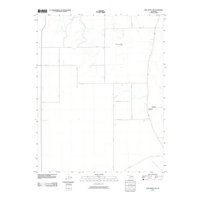
2010 Map of Fort Supply NW
USGS Topo · Published 2010About this map
Sand Creek defines the local drainage of this Harper County landscape, winding through a grid of rural roads that mark the area's agricultural divisions. Several named water control structures, including Oknoname 059051 Dam and Oknoname 05933 Dam, indicate managed water resources in this part of Oklahoma. The mapping shows a landscape of expansive rural sections connected by routes such as N1875 Rd and E0190 Rd. The presence of Oknoname 059054 Dam further emphasizes the reliance on small-scale impoundments to manage the intermittent flows common to this region. This survey captures the layout of North Central Oklahoma prior to significant modern changes, providing a clear view of the section-line roads and watershed engineering that support the local ranching and farming economy.
Find a feature on this map
17 named features on this map. Tap any name to fly to it.
Don’t see what you’re looking for? This feature index may not catch every label — zoom into the map to look around manually.
Map Details
Editions of this 2010 Fort Supply NW Map
This is the sole edition of this map. No revisions or reprints were ever made.
Other maps of this area

1955 · Woodward
USGS Topo · 1:250,000

1958 · Woodward
USGS Topo · 1:250,000

1970 · Buffalo SE
USGS Topo · 1:24,000

1970 · Buffalo
USGS Topo · 1:24,000

1971 · Rosston SE
USGS Topo · 1:24,000

1971 · May East
USGS Topo · 1:24,000

1971 · Fort Supply
USGS Topo · 1:24,000

1971 · Fort Supply NW
USGS Topo · 1:24,000

1971 · Fort Supply NE
USGS Topo · 1:24,000

1971 · Laverne NE
USGS Topo · 1:24,000